


Live Satellite Earth Map View
3.3135.00 Reviews
App Specs
- Version
- 2.4.6
- Updated On
- License
- Free
- Downloads
- 1,000,000+
- Developer
- Sky Labs Studio
- Categories
- Maps & Navigation
- Platform
- Android
Screenshots
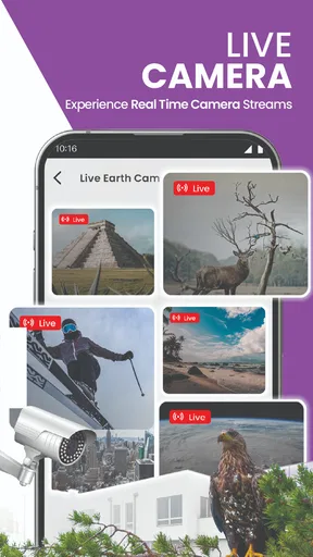
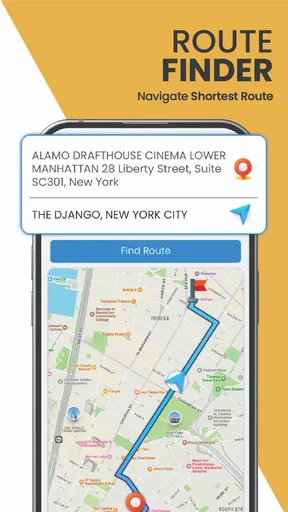
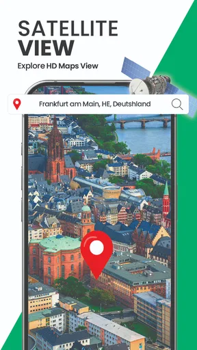
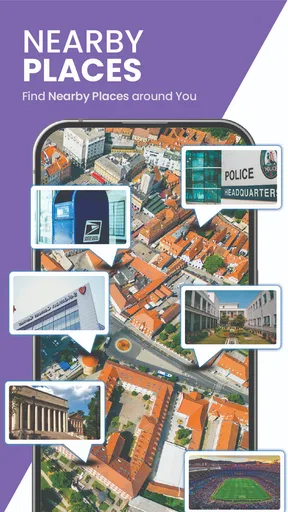
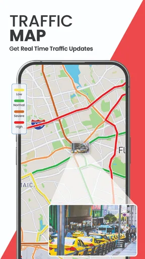
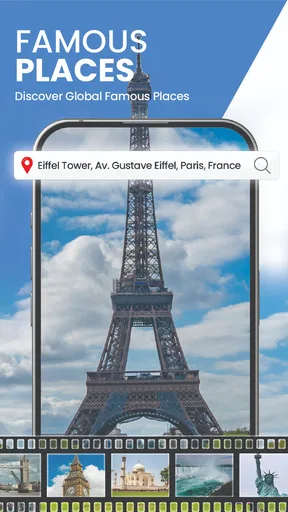
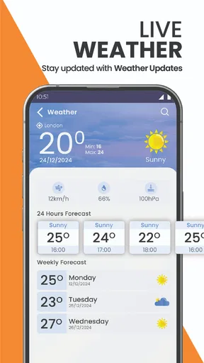
 Analysis by AppCompare
I found Live Satellite Earth Map View most appealing when I treated it as a way to look around and orient myself, rather than as a replacement for a dedicated route planner. It is a free maps and navigation app from Sky Labs Studio, and its mix of satellite imagery, a 3D view and current-location tools gives it a clear purpose: exploring places visually. The basic idea is easy to grasp, but the experience depends on what you need from a map at that moment.
Explore the World from Your Couch
First off, let's dive into what makes Live Satellite Earth Map View a standout. This app literally brings the world to your fingertips, offering a detailed satellite view of any location you can think of. Whether you're scouting out your next vacation spot or simply want to do a little virtual globetrotting, this app’s got you covered.
The interface is pretty intuitive. You get a map that you can zoom in and out of with a simple pinch, and the clarity of the images is top-notch. No more blurry pixels when you zoom in; it’s almost like you're hovering right over the location. Imagine being able to take a peek at the Grand Canyon or the Eiffel Tower without leaving your living room. Pretty neat, right?
All the Features You Need
What truly sets this app apart are the features. You’ve got your standard map view, but then there’s also this incredible 3D mode that makes everything pop. It’s almost like Google Earth, but with a bit more flair. The 3D effect gives you a more realistic feel of the terrains and structures.
Another cool feature is the real-time weather updates. Planning a trip? Just check the weather conditions in advance to avoid any surprises. You can literally watch a storm brewing from above, which is both fascinating and somewhat humbling.
And if you're a fan of landmarks, there’s a treasure trove of them available. You can click on any landmark to get more information, making it a fun and educational tool for kids and adults alike. It's almost like having a mini encyclopedia in your pocket.
What to Expect from Satellite Views
Satellite imagery is useful for seeing the shape of a place, but I would not treat a map image as a promise that every feature is current or equally clear. A roofline, field, road junction or shoreline can help me recognize an area, yet the image is not the same as standing there. For planning a visit, I use the view to get a broad sense of the surroundings, then check practical details with a current navigation source.
Worth Reading Before You Choose

Flipboard Shows What News Apps Must Do Beyond the Feed

Switching to Android Auto Means Rethinking Your Driving Routine

Google Calendar Makes a Crowded Week Easier to Manage

Ludo King Makes the Most of the Minutes Between Plans

Baby Panda World Brings Quick Play to Modern Phones, but Its Game Library Feels Busy

ESPN’s Live Game View Makes Following Close Games Easier
The 3D view is especially useful when the terrain itself matters. I find it easier to understand how hills, valleys and built-up areas relate when I can tilt the perspective, rather than trying to infer everything from a flat image. The trade-off is that a dramatic angle can make distances and slopes harder to judge. I switch back to a straightforward map view whenever I need a simpler sense of direction.
A small but useful habit is to zoom out before panning far away. It gives me a better sense of where I am in relation to a city or region and reduces the chance of losing my bearings while exploring. Then I zoom back in gradually, checking recognizable roads or landmarks as I go. This is a more dependable way to browse than jumping straight into a close-up and assuming the first image tells the whole story.
User Experience: Easy Peasy
The user experience is where Live Satellite Earth Map View really shines. Navigating through the app is a breeze. The controls are straightforward, and you won’t find yourself lost in a sea of menus. It's all quite self-explanatory, which is a blessing for those who aren’t exactly tech-savvy.
One thing I absolutely love is how quickly the app loads. There’s nothing more annoying than waiting ages for an app to load, especially when you’re eager to start exploring. Here, that’s a non-issue. It responds quickly, and the transitions between views are smooth and seamless.
When Setup or Loading Gets in the Way
If the map does not appear as expected, I start with the basics: check that the phone has a working internet connection, close and reopen the app, and give the map a moment to load before repeatedly zooming or dragging. Satellite imagery can take longer to render than a simple map view, especially when moving quickly across a large area. Trying one view at a time also makes it easier to tell whether the issue is loading or simply a change in perspective.
For the current-location view, I check that location access is available to the app in the phone’s settings and that the device itself can determine its position. If the marker is missing or seems misplaced, moving to an open area and waiting briefly can help the phone get a clearer location fix. I would not assume the app is broken just because a position takes time to settle indoors or among tall buildings.
The app is listed for Android 7.0 and later, so an older device that meets that minimum may still feel less smooth than a newer one. If performance is uneven, I close other demanding apps and try again before drawing conclusions. The current version is 2.3.7; keeping an app current is a sensible first check when troubleshooting, though it cannot fix a weak connection or a device struggling with map imagery.
A Practical Way to Use It
Suppose I am meeting a friend near a large park in an unfamiliar neighborhood. Before leaving, I can inspect the area from above, identify the park’s outline and nearby streets, and get a visual sense of which side of the park is closest to the meeting point. I would then use a conventional navigation app for live directions and timing. That division of labor is important: satellite browsing helps me understand the setting, while turn-by-turn navigation is the better tool for getting there reliably.
For a trip, I use the same approach to compare the surroundings of possible places to stay. A satellite view can help me notice whether a location appears close to a major road, open space or dense blocks. It cannot tell me whether a route is safe, whether a building is open, or how long a walk will take, so I treat what I see as a starting point for questions rather than a final answer.
It can also be a nice shared activity with a child or a curious friend: pick a familiar landmark, zoom out to see how it sits within its region, then compare the landscape with somewhere completely different. The landmark information makes browsing more engaging, but I still guide younger users to check names and locations rather than treating every visual impression as a fact. That turns casual exploration into a small geography exercise without asking the map to do more than it can.
Where It Fits Among Map Apps
Compared with the usual road-navigation apps, this one makes visual exploration the main attraction. A route-focused app is the better choice when I need live directions, traffic-aware decisions or a clear sequence of turns. Compared with a general-purpose map, the satellite and 3D emphasis is more satisfying when I want to inspect terrain or recognize a place from above. I see it as a companion for looking around, not a single app that should handle every travel task.
That distinction matters if you are preparing to drive somewhere unfamiliar. I would not rely on a satellite image alone for road closures, current access or the best route. For those decisions, I check a navigation service built around current routing. Likewise, if I need a precise address, transit details or a dependable walking route, I choose the tool designed for that job and use this app to build a visual picture of the destination.
The free price makes it easy to try, but it includes in-app purchases ranging from $2.49 to $14.99 per item. I would first decide whether the core map browsing suits me before spending anything; casual exploration may be all I need. Its Everyone age rating also makes the general concept accessible to a wide audience, while parents can still supervise any device use as they normally would.
Who Will Enjoy It—and Who May Prefer Another Tool
I think this app suits curious map users, travelers who like to preview a destination, and students who learn better when they can connect names to visible landscapes. It is also a pleasant choice for a few minutes of armchair exploration: start with a familiar place, follow the coastline or terrain, and see how the surroundings change as you move outward. The 3D perspective gives that kind of browsing more context than a flat map alone.
I would steer away from it as a primary tool if my main need were dependable navigation while driving, offline access, or highly practical local information. Those needs call for a service whose central purpose is route guidance or local search. Even a detailed overhead view cannot replace street-level observation, signs, live conditions or common sense on the ground. The app is most useful when I keep those limits in mind instead of expecting one map to answer every question.
Its audience figures suggest it has reached a substantial group of users, with over a million installs, but the average rating is 3.5 from around 4,200 ratings, alongside 119 written reviews. I take that as a reason to approach it with balanced expectations rather than assuming every session will be flawless. The app has an appealing, specific use, but how satisfying it feels will depend on connection quality, device performance and whether visual exploration is what I actually want.
Why You Should Download It
If you’re still on the fence, let me give you a gentle nudge. This app is not only entertaining but also incredibly useful. Whether you’re a traveler, a student, or someone who just loves learning about the world, this app has something for you.
It's also a great tool for educators. Imagine using this in a classroom setting to teach geography or history. Students are more likely to engage when they can visually see the places you’re talking about. Plus, it’s a great way to spark curiosity and encourage independent learning.
In an ever-connected world, having the ability to explore the earth in such detail is both a privilege and a joy. And let’s be honest, who doesn’t like to play around with maps? It’s a classic pastime that never gets old.
To wrap things up, Live Satellite Earth Map View is more than just an app. It’s your personal gateway to the world, right in your pocket. Easy to use, packed with features, and totally fun—what more could you want? So go ahead, give it a try and let the adventure begin!
Pros
- High-resolution satellite imagery.
- Real-time map updates.
- User-friendly interface.
- Customizable map views.
- Offline map availability.
Cons
- Requires constant internet connection.
- Can drain battery quickly.
- Limited free features.
- Occasional map loading delays.
- Ads can be intrusive.
FAQs for Live Satellite Earth Map View
What features does Live Satellite Earth Map View offer?
Live Satellite Earth Map View provides real-time satellite imagery and street maps, allowing users to explore the world from their device. It includes features like 3D terrain views, live traffic updates, and a search function for specific locations. The app also offers route planning and GPS navigation to enhance travel experiences.
Is Live Satellite Earth Map View available offline?
While Live Satellite Earth Map View excels in providing real-time data, it primarily relies on an internet connection to update satellite imagery and traffic information. However, users can download specific maps for offline use, which is helpful when traveling to areas with limited connectivity.
How accurate is the satellite imagery in the app?
The satellite imagery in Live Satellite Earth Map View is highly accurate and frequently updated. However, the accuracy can vary based on location and available data. Urban areas often have more detailed images than rural regions. The app continuously enhances its data to provide the best possible user experience.
Is Live Satellite Earth Map View free to use?
Live Satellite Earth Map View offers a free version with basic features, such as satellite and street views. For advanced functionalities like ad-free browsing, enhanced navigation tools, and offline maps, users might need to subscribe to a premium version. Pricing details are available within the app.
How does Live Satellite Earth Map View handle user privacy?
User privacy is a priority for Live Satellite Earth Map View. The app requires location access to provide accurate navigation and traffic data, but it ensures all collected data is secure. Users have control over their data and can manage permissions through their device settings to enhance privacy.


